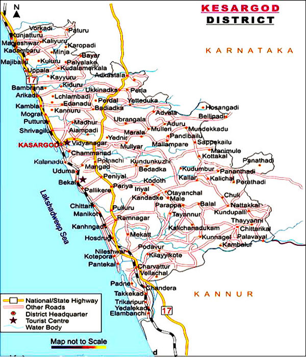
Kasaragod is one of the districts of the Indias state of Kerala. It forms the northern end of Kerala. To its south lies Kannur District and to the north Dakshina Kannada district of Karnataka state. All along its west it is walled by the Western Ghats while along the east the Arabian Sea borders it. The district, covering an area of around 1992 sq km, has a population (2001 census) of 1,203,342, and has two taluks, namely, Kasaragod and Hosdurg both being municipalities as well; 75 villages; 39 panchayats. The district is further sub-divided into four administrative segments called development blocks, namely, Manjeshwar, Kasargod, Kanhangad, and Nileshwar. Like other districts of Kerala, Kasaragod district too has a high literacy rate, around 85.17%. The Malayalam spoken here has influences from Tulu, Kannada, Urdu, Konkani etc. People from southern kerala generally find it difficult to understand the Malayalam spoken here. Kasaragod district has Arabian Sea to the west & Western ghats to the east.
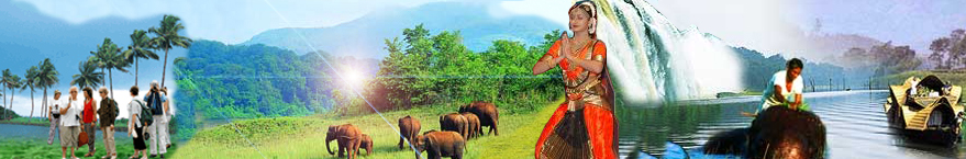
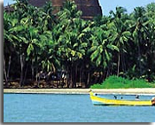
Kasargod is the northernmost district of Kerala and is famous for its coir and handloom industries. It is endowed with rich natural resources. The coastal regions abound in coconut and arecanut gardens while the midlands have extensive paddy fields. The Important crops in the hilly areas include rubber, cashew and ginger. Fishing is the prime source of livelihood. The district is a land of fabulous fantasies, it abounds in sacred temples with splendid architecture, majestic forts, ravishing rivers, undulating hills, verdant valleys and beautiful upspoilt beaches.
Boundaries
WEST - Arabian Sea, NORTH & EAST - Karnataka State, South - Kannur District.
History
The large number of forts, big and small like Bekal, Chandragiri, Hosdurg, Kumbala, Panayal, Kundamkuzhi, Bandaduka etc. reveal the historical importance of this land.
Kasargod was famous from time immemorial. Lying on the north western coast of the State,it was an easy access to many Arab travellers, who came to Kerala between 9th and 14th centuries AD, visited Kasargod as it was then an important trade centre. They called this area Harkwillia. Mr.Barbose, the Portuguese traveller,who visited Kumbla near Kasargod in 1514, had recorded that rice was exported to Male island whence coir was imported.
There are 12 rivers in this district. The longest is Chandragiri (105 km) originating from Pattimala in Coorg and embraces the sea at Thalangara.
The river assumes its name Chandragiri from the name of the place of its source Chandragupta Vasti; where the great Maurya emperor Chandragupta, is believed to have spent his last days as a sage. The second longest river is Kariankod (64 km), across which a dam is being built at Kakkadavu. Shiriya (61 km), Uppala (50 km), Mogral (34 km), Chitari (25 km), Nileswar (47 km), Kavayi (23 km), Manjeswar (16 km), Kumbala (11 km), Bekkal (11 km) and Kalanad (8 km) are the other rivers. These rivers provide ample irrigation facilities.
Agriculture
Agriculture forms the mainstay of the population of the district. The soil in the three natural divisions generally fall under three types. In the highland region it is laterite. In the midland, the soil is a red ferruginous loam of lateritic origin with an admixture of clay and sand. The coastal strip is sandy. Diversity of crops and heterogeneity in cultivation are the key notes of agriculture here.
The eastern tract comprises of forests and hilly areas. The forests comprise of a variety of timber with teak and other plantations. The hilly areas are mostly cleared and put to private cultivation; the important crops being rubber, cashew and ginger. In the skeletal plateau areas, cashew trees are cultivated, while in some patches, arecanut, pepper and cocoa are grown. In the coastal tract, paddy, coconut, arecanut, cashew, tobacco, vegetables and tapioca are cultivated.
Roads : NH 17 (85.9 km) passes through this district. From Kannur side it enters the district at Kalikadavu. It passes through the major towns Trikaripur, Cheruvathur, Nileshwar, Kanhangad, Kasargod, Kumbla, Uppla, Manjeshwar and enters Karnataka state at Thalappadi to Managlore. The 29 km State Highway connects almost all other towns with the National Highway.
Railway : The Kozhikode-Mangalore-Mumbai Route passes through Kasarkod district. The major Railway stations on the 116 km long rail route in Kasarkod district are Trikaripur, Cheruvathur, Nileshwar, Kanhangad, Kasargod, Kumbla, Uppla and Manjeshwar.
Airport : No airport in Kasargod District. The nearest Airports are at Mangalore (70 km) and Kozhikode (200 km).