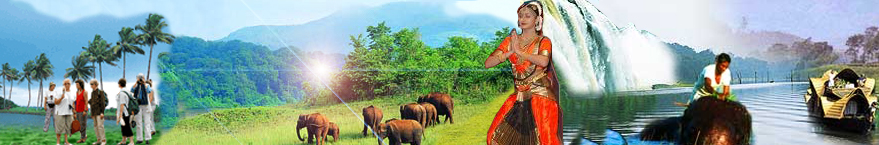
This palm-green commercial town of Kerala is one of the finest natural harbours in the world from where ships set sail for foreign ports with different products of Kerala, like seafood, pepper, rubber and coir. Across the bridge into the old city, there are bastions and streets built by the Portuguese over 500 years ago. It was here in St. Francis Church that the body of Vasco da Gama was originally buried. The enormous fishing nets on the sea front of Cochin provide a charming view.
Boundaries
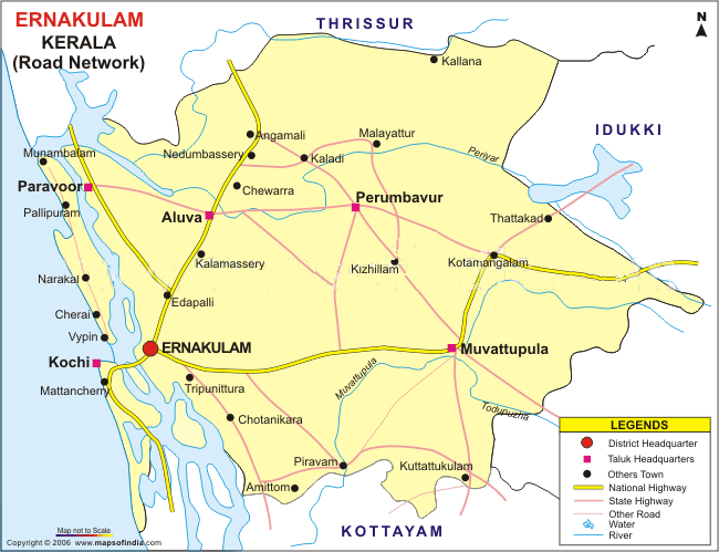
The district is bordered by the Arabian Sea in the West
Thrissur District in the North
Idukki District in the East
Alappuzha and Kottayam District in the South.
The famous river Periyar, flows through all the Taluks except Muvattupuzha.
Muvattupuzha River and a branch of Chalakkudy River provide a wide stretch of
backwaters to the Ernakulam district and is a major attraction of the place.
History
Ernakulam district was formed out of the erstwhile kingdoms of Travancore, Kochi and Malabar. The Kochi kingdom had a major share in the establishment of the district. The word Ernakulam was drawn from a Tamil word 'Erayanarkulam' which means abode of Lord Shiva's.
Ernakulam has the majority of islands in Kerala. The main islands of this district are Willington Island, the world's most populated Vypeen Island, Cheriya Kadamakkudi, Valiya Kadamakkudi, Ramanthuruthu, Ponjikkara, Vallarpadam, Kumbalam, Panangad, Cheppanam, Nettoor, Pizhala, Kankattuthuruthu, Korampadam, Cheranelloor, Chathanadu and Chendamangalam. It is believed that the formation of all these islands took place from the soil accumulated due to soil erosion of highlands.
One can see the impressions of Arabs, Chinese, Dutch, British and Portuguese seafarers, who followed the sea route to Kochi. The present Ernakulam District include Paravur, Aluva, Kochi, Kanayannoor, Muvattupuzha, Kunnathunadu, Kothamangalam Taluks which come under Fort Kochi and Muvattupuzha Revenue Sub Division.
Air - International Airport at Nedumbassery (20 km from town)
Rail - Ernakulam (Kochi) is a major railhead of the Southern Railway. Main Station : Ernakulam junction. Other stations : Ernakulam town & Kochi Harbour Terminus.
Road - An excellent road network links to all major towns and cities in india.
Ferry - There are two ferry stations in Ernakulam. The main boat jetty is one km from the junction railway station and the other is near the high court.
Where To Stay
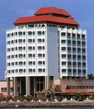
Le Meridien, Kundannur
Taj Malabar, Willington island
Hotel Avenue Reagent, Jos junction
Choice Sea Side Hotel, Cantonment, Ernakulam.
Centaur Tourist Home, M A Road.
Kamala International, S M Road.
Kavitha Tourish Home, S N Park.
Motel Aram, Kalliassery.
Omars Inn, Station Road.
Yatri Nivas (KTDC), Near Police Club.
Bharat Hotel, Ernakulam.
Casino Hotel, Willingdon Island.
Dwaraka Hotel, Ernakulam.
Ganam Hotel, Ernakulam.
Grand Hotel, Ernakulam.
Where To Eat
Hotel Abad, Near Kavitha theatre, MG Road.
Bimbis, Jos junction
Hotel Sealord, Menaka
Ceylon Bake House (Chicken Biriyani fame), Near Menaka
Hotel Anugraha (Vegetarian), Vytilla Junction, Ph : 0484 2389461.
Hotel Dwaraka, Near Medical Trust Hospital, MG Road
Hotel Avenue Reagent, Jos junction, MG Road
Hotel Abad Plaza, Near KSRTC stand, MG Road
Hotel Gee Bee Palace, Near Railway station, Angamaly. Ph: 0484 2458705